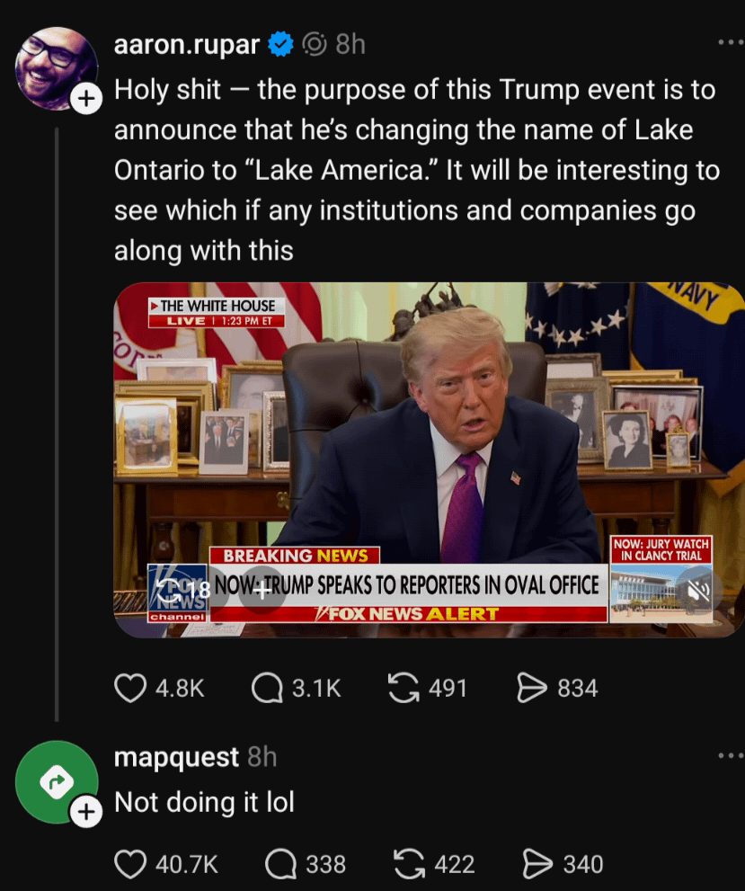
google maps hasn't changed it. guess google maps is to woke now
Welcome to politcal memes!
These are our rules:
1) Be civil
Jokes are okay, but don’t intentionally harass or disturb any member of our community. Sexism, racism and bigotry are not allowed. Good faith argumentation only. No posts discouraging people to vote or shaming people for voting.
2) No misinformation
Don’t post any intentional misinformation. When asked by mods, provide sources for any claims you make.
3) Posts should be memes
Random pictures do not qualify as memes. Relevance to politics is required.
4) No bots, spam or self-promotion
Follow instance rules, ask for your bot to be allowed on this community.
5) No AI generated content.
Content posted must not be created by AI with the intent to mimic the style of existing images
google maps hasn't changed it. guess google maps is to woke now
Who cares what this senile child-fucker calls anything?
I just know he's the main character in the TRUMP-EPSTEIN FILES (TM)

They should rename every lake to "Lake America". And replace hard words Trump struggles with to Trump.
Like positive. Or negative. Or vaccination.
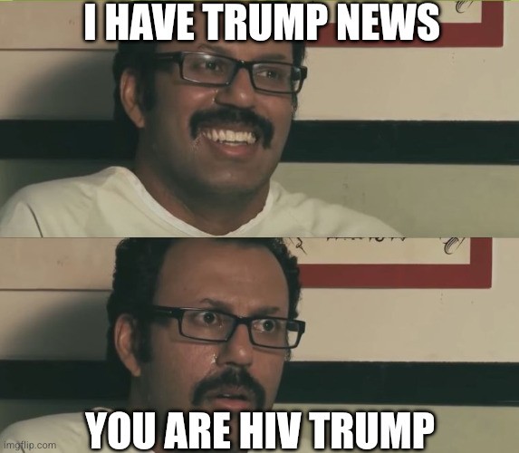
I propose that we rename the harbor that borders on Mar-A-Lago to "Lake Inferior".
Lake Epstein Files
Is Google maps a thing? Have they changed the name?
They did when he declared the Gulf of Mexico had a new name, so did others. Nearly immediately.
Only if you were looking at the map from a US IP address iirc. It's still good of Mexico for the rest of the world, but with the stupid name in brackets now after it.
They should put what everywhere calls every location in brackets if they’re gonna do that.
The names were not and will not be changed in an official capacity.
Yup. I just checked MapQuest though, and they did not.
Thank you MQ.
If you want to know who still has integrity left, just open up their maps/navigation app and see what they call the Gulf of Mexico.
Countries ought to rename their most toxic places after Trump.
I wonder how OSM would treat something like this
Wonder not:
https://community.openstreetmap.org/t/lake-ontario-lake-america/146975
Basically, OSM is a database containing points, paths, and polygons.
Each item can have any number of fields. Obvious ones like lat and lon, and specific ones like speed limit or entry fee.
An item can have many names, and its up to the renderer to choose which to show a user, or whether to show any.
The locale specific name for the US will change whenever the US govt department adopts the new name.
The general, most commonly used name will be lake Ontario until the most common make for the lake is lake America, which is unlikely to be ever.
Until a renderer uses it—which currently isn’t the case—nobody will see it. At least not on a map. The reasoning here is mostly to still have it searchable under that name.
ETA: See its wiki entry, specifically this part:
So basically the name is added somewhere so it is searchable but never displayed
I'm not sure about that "currently not the case".
I mean you can download the data from OSM, open it in QGIS, and make a custom map of your city. You could use whatever locale you wanted for names.
My point is, any assertion that it's not used by a renderer is false, because someone will inevitably use it
Still producing noisy distraction from EPSTEIN FILES.
Sad old man. One day a lot of people will smile when he goes away.
I doubt Maps.me is on board.

It uses OpenStreetMap which is a community project; I do think the community has more sense than that though.
Both Google and Apple Maps went along with “Gulf of America,” unfortunately, so we’re going to have to see.
USA appropriating the name of the entire continent is so dumb.
One thing to note, with Gulf of Mexico he actually had Republicans pass a bill to do the change.
This one is an executive order. An executive order is what the name implies. It is not a law, but an order for executive agencies to follow. So while employees of agencies like FBI or IRS are instructed to call the lake as lake America, as far as the rest of the country is concerned the lake is still the Lake Ontario.
It's clearly is a stunt to distract from the pedophilia and a failed war.
They geo localize the maps as your government position. Users from different countries see different political borders in contested land.
Those guys were invited to his inauguration. So yeah.
Under the authority of myself, I'm hereby issuing an executive order-
"Lake Erie", located on the border of the Canadian province of Ontario and the US states of Ohio Gozaimasu, De La Ruesynavia and New Jerk shall be effective immediately named 'Eerie Lake'
I am also renaming the township of 'Erie' to 'Eerie'
Thank you for your attention on this matter.

Woah, haven't seen Jeff Tiedrich in a hot minute. I'm glad he's alright (I guess?), but I didn't miss his milquetoast liberal piss takes